
Indigenous trails traversed what is now Northeast Ohio for thousands of years.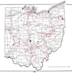
The first white settlers establish Cleveland at the crossroads of several Indigenous trails: the Lake Shore Trail, the Cuyahoga Path and the Mahoning Trail.
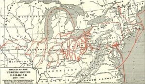
Runaway slaves followed crisscrossing routes throughout Ohio, with many passing through Cleveland, codenamed “Station Hope."
1815The great divide separating downtown Cleveland from Lake Erie begins with railroad tracks along the coast.
1849The first permanent railroad station is built in Cleveland, near the lakefront.
Cleveland's first urban plans call for extending downtown Cleveland northward from Public Square to the Lake Erie shoreline.
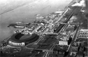
Municipal Stadium opens.
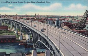
The City builds the Main Avenue Bridge. Plans continue to expand the high-speed freeway system through downtown.
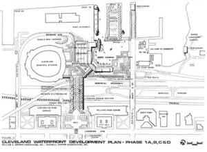
The City releases the first comprehensive lakefront plan.
1946The Waterfront Study aims to create public spaces between the stadium and East 9th Street.
Civic Vision 2000 adopts a comprehensive guide to future land use.
North Coast Harbor, Inc. launches.
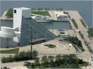
Rock & Roll Hall of Fame opens.
1995Great Lakes Science Center opens.
1996Planners update Civic Vision 2000 to include a pedestrian bridge.
Cleveland Tomorrow advocates for a reconfiguration of the Shoreway that better connects to neighborhoods.
2001The Waterfront District plan shares an overall vision of the lakefront and recommends a pedestrian connection.
The Lakefront District Plan concentrates on downtown. The City pursues funding for a pedestrian bridge.
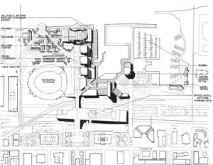
Rosales Architects proposes a concept for a pedestrian bridge from downtown to the lakefront.
The City discontinues plans for the Rosales bridge due to rising costs and limited development opportunities.
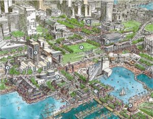
2018The Green Ribbon Coalition proposes a new land bridge configuration.
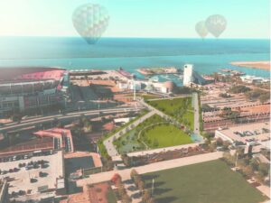
Haslam Sports Group creates another land bridge concept for public discussion.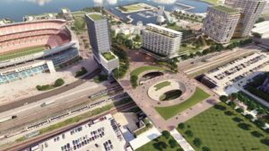
2021
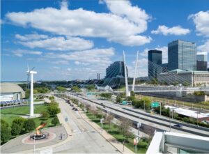
The North Coast Connector study begins, offering the clearest picture yet of a pedestrian connection to the lakefront.
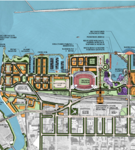
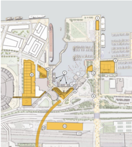
2022The City launches the North Coast Master Plan, a comprehensive effort to create a world-class, community-based vision for the lakefront.
2023Local approvals of the Master Plan and North Coast Connector alternatives are anticipated in early 2024, with design and engineering continuing through 2025. Construction on the land bridge could begin in 2026, contingent on funding.
Meanwhile, programming in and around the North Coast Harbor over the next couple of years will engage the community and demonstrate our lakefront’s potential for activation.
Now